Desert: The Mojave
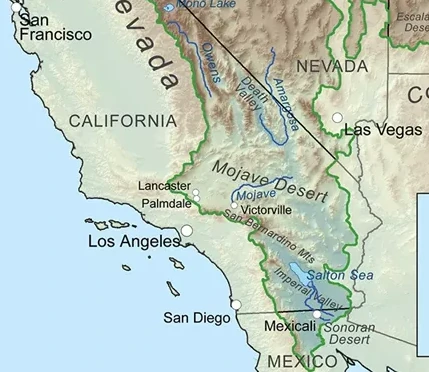 Before the changes wrought by the Great War, the Mojave Desert was the smallest and driest of North America’s four (Great Basin, Sonoran, Chihuahuan, Mojave) major deserts.
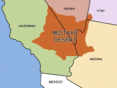
Collectively, these four deserts comprised the North American Desert, an arid ecoregion created by the rain shadow cast by the Cascades, Sierra Nevada, Transverse, and Peninsular Mountain Ranges to its west. Historical accounts state that the Mojave Desert encompassed 54,000 square miles in what were once the states of California and Nevada. It was bordered to the west by the Sierra Nevada and California montane chapparal and woodlands, and to the south and east by the Sonoran Desert.
Such area estimates may no longer be accurate and it may be more appropriate to revert to the idea of the “North American Desert”, but descriptions of the Mojave Desert will be retained in this document to highlight local resources and hazards. The Mojave Desert derives its name from the indigenous Mojave Tribal Nation, whose endonym Hamakhaave translates to “Beside the Water,” as they once held ancestral lands along the Colorado River.
Geology
 The Mojave Desert is bordered to the southwest by the San Andreas Fault and to the north by the Garlock Fault (roughly 40 miles north of Fort Edwards). The Mojave Desert has basin and range topography with a typical pattern of parallel mountain ranges and valleys. For the desert wanderer, this means that millions of years of geological history may be exposed within a comparatively small area, potentially providing access to valuable minerals or tool stone.
Deposits of copper, tin, lead, manganese, and iron are known to exist. If one is fortunate, impermeable layers of stone may bring small amounts of fresh water to the surface as seeps or springs.
Two permanent natural springs within the Mojave Desert are Ash Meadows and Oasis Valley (both near Death Valley, in what was once western Nevada). The parallel ranges and valleys can also be exploited for reconnaissance and for setting up (or eluding) ambushes.
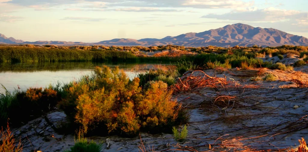 Alluvial fans, called bajadas, descend from the mountains toward lower elevation basins, such as the one in which Fort Edwards was built. These lower elevation basins contain dry lake beds called playas. During infrequent rain events, playas collect water and teem with plant and animal life until the water evaporates. Indigenous populations took advantage of this and you should too. Sedentary communities may find that evaporites from playas, typically salts, may have trade value.
Large playas, such as Rogers Dry Lake (Edwards Air Force Base) located just south of Fort Edwards, were conducive to weapons testing before the Great War. While salvageable pieces of technology may be present, the abundance of unexploded ordinance and chemical contamination at these and similar military facilities discourage their exploration.
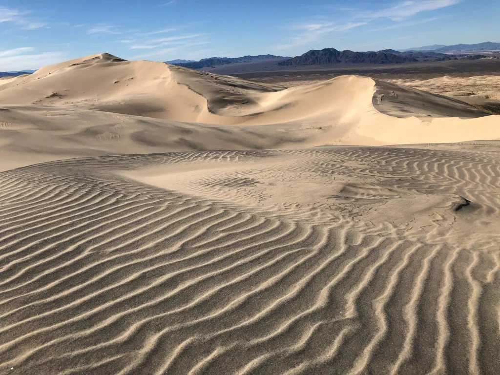 Of particular geological note, the Kelso Dune Field, located roughly 160 miles east of Fort Edwards in the former Mojave National Preserve, is the largest field of aeolian (wind deposited) sand dunes in the Mojave Desert. The dune field contains 45 square miles of migrating dunes, vegetation-stabilized dunes, and sand sheets.
The Kelso Dunes are notable for their “singing sands” which produce a low-frequency rumble when disturbed. A similar effect has been observed in the Eureka Dunes, near Death Valley. Astute travelers may wish to consider how such phenomena could give away their position, or be used to deceive an adversary.
Climate and Weather
The Mojave Desert is characterized by temperature extremes throughout the year with temperatures rising to nearly 120 °F in the summer, and freezing temperatures are not uncommon in the winter, with snow and rain falling in the mountains. Similarly, daytime and nighttime temperatures may also vary dramatically, so plan for both extreme heat and frigid cold. Strong winds typically precede rapid changes in temperature, but often diminish as evening falls.
When making camp, be alert to indicators of prevailing wind (such as dune deposits) and plan accordingly. Seek cover on the leeward side of rock formations or vegetation. Strong winds suspend dust and sand within them, which acts as an abrasive to exposed skin and equipment, and over prolonged periods may cause silicosis and other lung ailments. Aside from introducing medical ailments (which will be discussed in greater depth later), desert winds may dramatically reduce visibility, prevent audible communication, make movement difficult, and make tracking nearly impossible.
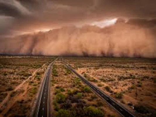 Haboobs
Of particular note, a haboob (or habub) is an intense dust storm created by strong winds from weather fronts or thunderstorm downdrafts. Although the term is derived from Arabic (haab is a root meaning “to blow”), they occur in arid and semi-arid regions throughout the world. They are regularly seen in the Sonoran Desert during monsoon season. Haboobs can rise to 7,000 feet in height, advance at speeds of 45 miles per hour, and can last as long as 6 hours.
You’ll get much more information about the Mojave Desert plants, animals and environment in the Operations Section of this manual and through the Ranger Basic Course.